Select NOAA-NWS Forecast Office Text Products
(Product availability varies with seasons, forecast office, and weather.)
Forecast Discussion for Aberdeen, SD
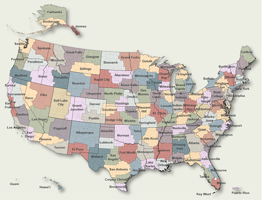
To Select Another NWS Office Click on Map or Choose from List
|
| Select Forecast Office: | Select Product: |
000 FXUS63 KABR 270855 AFDABR Area Forecast Discussion National Weather Service Aberdeen SD 355 AM CDT Sat Apr 27 2024 .KEY MESSAGES... - Lingering clouds today, with diminishing coverage of light rain/drizzle as storm system departs. Additional rain amounts less than one-quarter inch. - Active pattern continues, with additional chance for rain Sunday, Tuesday, and Thursday. Rainfall amounts on Sunday have increased slightly, peaking around 1 inch in northeast SD, with lower amounts in western and central SD. The systems for next week have much lower overall moisture potential as well. - Below to near normal temperatures through the extended. && .SHORT TERM /TODAY THROUGH SUNDAY AFTERNOON/... Issued at 355 AM CDT Sat Apr 27 2024 Low pressure is centered over southern Minnesota early this morning, with plenty of low clouds lingering over the CWA. Also seeing a few pockets of light rain, with areas of drizzle as well. The drizzle (and even fog) have developed generally east of the Missouri River, and especially in the Coteau region where winds are lightest. Added mention of drizzle/fog for the morning hours, but should see visibility improvement as the north winds begin to increase. Also, areal coverage of rain showers will be limited today as the low pressure continues moving away from the region. Although, clouds look to stick around, with HREF low cloud cover ensemble mean staying rather high across the CWA through the day. So, will not see much in the way of temperature rises today, with most areas stuck in the upper 40s to mid 50s. Models suggest clouds will stick around into the overnight hours as well, therefore leaned more towards NBM75th for lows. Next area of low pressure begins moving northward across the Central Plains on Sunday, ending up somewhere near Sioux City or Omaha by 00Z Monday. This system will spread rainfall northward across the area through the day Sunday. Due to a lack of instability, only looking at a slight chance of embedded thunder. Examining deterministic and ensemble/probabilistic data, it appears rainfall amounts could range from around a half inch to 1 inch for eastern portions of the CWA. Although, 75th percentile HREF members are closer to 1.25 inches for eastern portions of the area. && .LONG TERM /SUNDAY EVENING THROUGH FRIDAY/... Issued at 355 AM CDT Sat Apr 27 2024 We will be stuck under the longwave trough over the next several days, and while there will be variations in how broad this trough is, the end result is an active pattern, with near to below normal temperatures, though the extended. Will open with a shortwave nearly overhead Monday morning, lifting northeast. Probabilities for moisture still show a high range with the 24 hour QPF 25th/75th percentiles for Aberdeen between 0.36 and 1.23... GEFS plumes show nearly an inch difference between the higher end ensembles vs the lower...though the mean is much lower compared to the deterministic QPF. A similar trend exists for Watertown with more overall QPF, and for Mobridge/Pierre though with lower overall QPF. Thus, key takeaway is that there is still quite a bit of uncertainty in overall rainfall amounts. A very short break will occur between systems, with the low departing in the east and the next low developing over Wyoming during the day Monday. The next shortwave track is almost directly west to east, though the surface low is elongated, with a narrow axis of milder air (warm tongue) being dragged up from the south around then back into north central North Dakota. This warm air will only be over us for a short period, mainly during overnight hours, but as it mixes out Tuesday should see a rapid warmup. This is short lived however, and there is a tighter thermal gradient behind the system, despite a less intensely cold airmass in comparison to the departing system Monday. The end result, overall less moisture with this system, and more wind. Probabilities for exceeding 45mph are limited to west of Mobridge (around 50 percent), otherwise the 25th/75th range is in the 30-35 to 40-45mph range. Next system comes in late in the period (Thursday night/Friday) but still quite a bit of uncertainty with track/timing, looking like it will be a weak Colorado low type system with the Dakotas well north of any spring-like warmth or humidity. && .AVIATION /06Z TAFS THROUGH 06Z SATURDAY/... Issued at 1245 AM CDT Sat Apr 27 2024 Terminals KABR,KATY,KPIR,KMBG Scattered -SHRA and areas of -DZ/-RA will continue through the night and into early Saturday. After the morning hours, areal coverage of precipitation is expected to decrease. IFR/MVFR CIGs are forecast to continue through the TAF period. There may be periods of MVFR VSBY in BR, especially at KATY early in the period. Lower confidence of this occurring elsewhere, but will continue to monitor and amend as necessary. && .ABR WATCHES/WARNINGS/ADVISORIES... SD...None. MN...None. && $$ SHORT TERM...TMT LONG TERM...Connelly AVIATION...TMT/TDK |
Previous Forecast Discussions may be found at
NWS Aberdeen, SD (ABR) Office Forecast Discussions.
(Click 'Previous Version' there to view past versions successively.
Some may differ only in time posted.)
Products Courtesy of NOAA-NWS
NWS Information Parsing Script by Ken True at Saratoga Weather - WFO and Products Scripts by SE Lincoln Weather.
Mapping by Curly at Michiana Weather and by Tom at My Mishawaka Weather.