Select NOAA-NWS Forecast Office Text Products
(Product availability varies with seasons, forecast office, and weather.)
Forecast Discussion for Aberdeen, SD
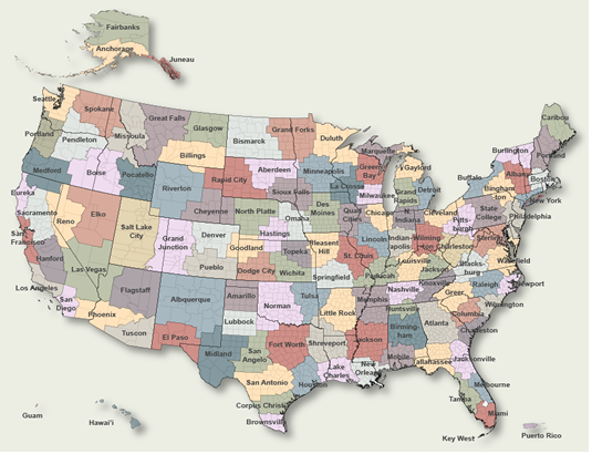
To Select Another NWS Office Click on Map or Choose from List
|
| Select Forecast Office: | Select Product: |
000 FXUS63 KABR 291737 AAC AFDABR Area Forecast Discussion...UPDATED National Weather Service Aberdeen SD 1237 PM CDT Mon Apr 29 2024 .KEY MESSAGES... - Precipitation gradually ending today as low clouds erode from west to east. Passing cold front on Tuesday brings another round of showers and thunderstorms. - Additional systems for late Wednesday, Thursday and Saturday though overall less moisture is expected with these systems. - Below to near normal temperatures through the weekend. && .UPDATE... Issued at 1017 AM CDT Mon Apr 29 2024 Held clouds in longer over the region today. There`s only been a very slow wobble east in the clearing so far. Also lowered highs a couple of degrees to account for the expected persistent cloud cover in the east. && .SHORT TERM /TODAY THROUGH TUESDAY AFTERNOON/... Issued at 344 AM CDT Mon Apr 29 2024 Still seeing areas of rainfall/drizzle across the CWA as the upper low spins overhead. This low moves east through the day, gradually bringing an end to the precipitation. Cloud cover will take its time to erode as well, but should see a gradual clearing from west to east through the day according to HRRR/HREF low-level cloud products. Highs will remain cool across the east, where precip and clouds are expected to hang on the longest. Here, highs are likely to top out in the upper 40s to low 50s. Across central SD where sunshine should emerge by this afternoon, 60s are forecast. Return flow sets up overnight as warmer air aloft begins overspreading the region. At the surface though, fairly light winds and mostly clear skies initially should allow for temps to drop down into the 30s for many locations before cloud cover eventually does increase once again (at least across central SD) between about 09Z and 12Z Tuesday. There is some potential for fog, mainly over eastern areas where radiational cooling conditions look to persist the longest. Did not insert into the forecast quite yet as confidence isn`t overly high, but something for the day shift to consider. Focus then shifts to Tuesday as a cold front moves eastward across the CWA. Mid-level shortwave energy associated with this as well, so once again the stage is set for precipitation to move across the region. Environment is characterized by high shear and low CAPE, so thunderstorms definitely a possibility, but chances for strong/severe storms seem somewhat limited. Better low-level moisture and instability set up just to our south over southeast SD into eastern NE and western IA, where better chances for severe storms reside. That said, given the high shear environment (40-50 kts 10m AGL-500mb) and limited instability over the far southeast CWA, would not be surprised if a few stronger storms get going. 1-hr max 2-5km UH >75 showing up mainly over FSD CWA, but the northern fringe of does flirt with the CWA border near Hamlin/Deuel counties. && .LONG TERM /TUESDAY EVENING THROUGH SUNDAY/... Issued at 344 AM CDT Mon Apr 29 2024 Showers and Thunderstorms in the far east will rapidly depart early in the period (Tuesday evening) according to CAMS/NBM. Weak high pressure follows for Tuesday night into Wednesday while a Colorado low develops to the south. Upper flow is west/southwesterly, and there is actually evidence in the GFS/NAM for one of these weak embedded wave lifting into the western portion of the state during the afternoon/evening Wednesday prior to the influence of this Colorado low. The end result appears to be fast moving (in excess of 50-60kts) mid level showers. The rain associated with the Colorado low then falls mainly on Thursday, with the low moving from Kansas to Iowa before lifting across Minnesota and back into southern Manitoba. This means, that while moisture will mostly come in one wave Thursday, we`ll be stuck in a cool Canadian airmass wrapping back across the Dakotas, with plenty of low level moisture to generate clouds/light rain...and any sunshine will instantly destabilized the low levels for additional shower activity...thus the prolonged period of POPs that run through Friday even though the system is lifting away. With the upper low over North Dakota/southern Canada, zonal flow develops for Saturday, with a subtle wave crossing quickly, providing for another bout of mid level warm advection/upglide related precipitation. The upper trough is so persistent that it might take until late in the weekend or early next week before temperatures shift back towards normal or even a little above normal and we start to dry out. && .AVIATION /18Z TAFS THROUGH 18Z TUESDAY/... Issued at 1235 PM CDT Mon Apr 29 2024 Terminals KABR,KATY,KPIR,KMBG The clearing line on the clouds and rain will progress slowly from west to east through this evening. Until that moves through the region, MVFR cigs are expected to prevail. MVFR cigs will push back in with a fropa on Tuesday that will also bring more rain to the area. && .ABR WATCHES/WARNINGS/ADVISORIES... SD...None. MN...None. && $$ UPDATE...Wise SHORT TERM...TMT LONG TERM...Connelly AVIATION...Wise |
Previous Forecast Discussions may be found at
NWS Aberdeen, SD (ABR) Office Forecast Discussions.
(Click 'Previous Version' there to view past versions successively.
Some may differ only in time posted.)
Products Courtesy of NOAA-NWS
NWS Information Parsing Script by Ken True at Saratoga Weather - WFO and Products Scripts by SE Lincoln Weather.
Mapping by Curly at Michiana Weather and by Tom at My Mishawaka Weather.