Select NOAA-NWS Forecast Office Text Products
(Product availability varies with seasons, forecast office, and weather.)
Forecast Discussion for Aberdeen, SD
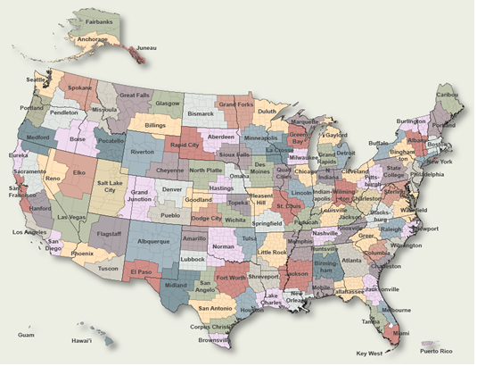
To Select Another NWS Office Click on Map or Choose from List
|
| Select Forecast Office: | Select Product: |
275
FXUS63 KABR 022339 AAA
AFDABR

Area Forecast Discussion...UPDATED
National Weather Service Aberdeen SD
639 PM CDT Sun Aug 2 2026

.KEY MESSAGES...

- A Heat Advisory remains in effect into early this evening for
  Corson, Dewey, Stanley, and Jones counties. Heat indices
  upwards of 100 degrees will be possible over that area.
  Temperatures are set to cool down to below normal for Tuesday
  and Wednesday.

- A Red Flag Warning has been issued for Monday afternoon and
  evening over portions of central and north central South
  Dakota due to dry fuels and 20 to 30 mph north winds,
  including gusts up to 40 mph.

- Storms may develop along a cold front moving over the area
  late Monday into early Tuesday. A Marginal Risk (Level 1 of
  5) is in place for parts of northeastern and central South
  Dakota, as well as western Minnesota. A Slight Risk (Level 2
  of 5) clips part of far northeastern South Dakota and western
  Minnesota. With these storms, the main severe threats will be
  hail of one to two inches in diameter and wind gusts of 60 to
  70 miles per hour.

- An area of near surface smoke is expected to sweep through the
  region on Monday behind the cold frontal passage.
  Concentrations of smoke may be high enough to be able to smell
  smoke in the air, and reduce visibility down to 3 miles or
  less. Air quality is expected to drop Monday and Monday night.
  Those with breathing sensitivities should plan accordingly.

&&

.UPDATE...
Issued at 629 PM CDT Sun Aug 2 2026

The aviation discussion has been updated for the 00Z TAFS.

&&

.DISCUSSION...
Issued at 120 PM CDT Sun Aug 2 2026

At 1 PM CDT, skies are mostly sunny (smoke aloft noted on satellite
imagery and looking outside), and temperatures are warming into the
80s and 90s. Heat Index values are increasing into the 90s
throughout and west of the Missouri River valley. Relative humidity
values across that same region are beginning to drop below 30
percent. Winds are out of the south at 15 to 25 mph with gusts up to
35 mph.

Ensembles clusters analysis and deterministic GSM output still
saying the positive tilt upper level ridge, bringing the heat today,
will be displaced off to the east while Pac NW/western Canada upper
level troffing moves east and knocks 500hpa heights down Monday
through Wednesday. Rather flat upper level western CONUS
ridge/central-eastern CONUS trof looks to set up for Thursday
through Sunday, leaving quasi-zonal to muted northwest flow over
this CWA. Not a very noteworthy signal for precipitation showing up
in the forecast right now beyond any Monday/Monday night
precipitation potential.

There is confirmation, upstream, of the HRRR`s near-surface smoke
progs, per the surface observations reporting reduced visibility out
over the northwestern CONUS/southwestern Canada. The HRRR draws this
near surface smoke down across the CWA on Monday into Monday night.
Incorporating that information (for smoke mention) into the
forecast. By Tuesday, air quality should be improving as the area of
near surface smoke advects further south and east. Unfortunately,
the flow pattern aloft will likely be continuing to steer wildfire
smoke, aloft, over this CWA Tuesday and beyond.

Low confidence in getting the max temperatures right on Monday with
a cold frontal passage happening, and potentially some morning and
late afternoon through late evening thunderstorms. Certainly, warmer
(upper 80s to mid 90s) temperatures expected on Monday out ahead of
the boundary, and cooler temperatures behind it. Guidance is still
showing some widespread windy north-component winds over, at least,
the central/north central zones of the CWA, post frontal, on Monday.
And, while afternoon RH values may even be a tish higher on Monday
than this afternoon, collaboration has yielded a Red Flag Warning
across the central/western portions of the Dakotas on Monday.

The cold front moving through on Monday would serve as a low level
focusing mechanism for late afternoon/evening convection to develop
on, provided mid-level cooling can happen enough to erode mid-level
thermal capping. If convection can develop, there is more than
adequate dynamic/thermodynamic support for supercellular storms,
carrying a large hail/damaging wind threat.

Below normal (lows near 50F! Tuesday night) temperatures are
presented in the various ensembles temperature guidance Tuesday and
Wednesday before a warm up is set in motion for the rest of the 7-
day.

&&

.AVIATION /00Z TAFS THROUGH 00Z TUESDAY/...
Issued at 629 PM CDT Sun Aug 2 2026

Terminals KABR,KATY,KPIR,KMBG

Prevailing VFR conditions can be expected at all terminals
through this forecast cycle. Southerly winds will remain gusty
tonight into Monday. Low level wind shear (LLWS) will be
possible by late this evening and early overnight for
KABR/KPIR/KMBG terminals. Patchy wildfire smoke will linger
across the area tonight into Monday across central South Dakota
and portions of northeast South Dakota.

&&

.ABR WATCHES/WARNINGS/ADVISORIES...
SD...Heat Advisory until 9 PM CDT /8 PM MDT/ this evening for
     SDZ003-015-033-045.
     Red Flag Warning from noon CDT /11 AM MDT/ to 9 PM CDT /8 PM
     MDT/ Monday for SDZ003-015-016-033-034-045.
MN...None.

&&

$$

UPDATE...Vipond
DISCUSSION...10
AVIATION...Vipond
|
Previous Forecast Discussions may be found at
NWS Aberdeen, SD (ABR) Office Forecast Discussions.
(Click 'Previous Version' there to view past versions successively.
Some may differ only in time posted.)
Products Courtesy of NOAA-NWS
NWS Information Parsing Script by Ken True at Saratoga Weather - WFO and Products Scripts by SE Lincoln Weather.
Mapping by Curly at Michiana Weather and by Tom at My Mishawaka Weather.